
Drone Photography & Video.
Aerial stills and 4K aerial video for property, development and brand work. Every flight is planned around the airspace, the wind and the site — daylight, visual line of sight, below 400ft, with written property consent on file. Controlled-airspace and commercial-for-hire flights are booked through a certified partner operator.
Aerial photography changed what a property listing looks like. The plate that shows the boundary line, the driveway, the pool and the neighbouring lots in one frame does more to justify an asking price than any number of interior shots. It also shows the thing a ground-level camera can never show: where the property sits. The mountain behind it, the greenbelt beside it, the walk to the beach, the distance to the highway. Buyers make a shortlist decision on that single frame.
The aerial side of TimeSake Media is run as a planned operation rather than a bonus at the end of a shoot. Flights are planned the night before against the airspace and the weather, flown in daylight within visual line of sight and below 400 feet, with written consent from the property owner on file and an agreed launch and landing point that keeps the aircraft away from people and neighbouring stands. Where a job sits inside controlled airspace, needs a night or beyond-line-of-sight flight, or is a commercial-for-hire brief that calls for a certified operator, we book it through a partner who holds the relevant SACAA approvals rather than flying it ourselves. Nothing is flown grey, and no agent or developer is ever exposed on our behalf.
How we plan a flight
Every flight starts with three checks the night before: the airspace over the address, the wind and cloud base for the shoot window, and the consent position on the ground. Daylight, visual line of sight, below 400 feet and clear separation from people and neighbouring property are non-negotiable, and we agree a launch and landing point with the agent or estate manager before the day so the aircraft is never lifting off from a public pavement or a neighbour's verge. Each flight is logged with coordinates, launch time and battery cycle, which is what an estate manager or body corporate asks for when they want assurance. Jobs that need controlled-airspace clearance or a certified commercial operator are booked through a partner with the relevant SACAA approvals, quoted transparently and scheduled around their availability.
Coastal and Winelands wind
Cape Town costs drone shoots more days than any other factor. The southeaster typically comes up at 10:00 or 11:00 in summer and pushes wind speed well above the aircraft's stable operating envelope by lunchtime. We book Bloubergstrand, Big Bay, Camps Bay, Clifton and Llandudno flights for the first two hours after sunrise, keep a second morning slot as a rain check, and never promise a same-day exterior. Winelands flights around Constantia, Franschhoek and Stellenbosch fare better in the afternoons when the mountain shelters the vineyard from the wind. Hout Bay is a specific coastal microclimate — the wind funnels through the valley and the drone gets grounded quickly.
Highveld thunderstorms and altitude
Johannesburg drone work has the opposite problem: it is calm in the morning and violent in the afternoon. Summer thunderstorms build from the west from about 14:00 and the outflow winds arrive 30 minutes before the rain. We finish all exterior aerials by 13:00 in December through March and shift longer flights to winter months where the Highveld light is cleaner and the storms are absent. Altitude is a real consideration too — the aircraft loses roughly 15% of its rated flight time at 1700m above sea level, and we plan battery cycles around it so the pilot is never over a property with a red battery warning.
What the aerial plate shows
The core aerial package for a property is three plates: a top-down site plan at about 80m showing the stand size and boundary, a hero establishing shot at about 40m that includes the mountain or sea backdrop, and a low reveal at about 15m that carries the eye from the pool up to the front elevation. Estate homes add a wide plate that shows the security context — perimeter wall, guarded gate, greenbelt — which is a real driver for the family buyer market. Commercial and industrial mandates get a very different set: a top-down that reads the tenant mix, a corner elevation for the leasing brochure, and a parking plate for the yield story.
Data delivery and licensing
Every drone shoot ships eight to fifteen edited stills at 20 megapixels, a 30-second aerial reel where the brief calls for it, and the GPS-logged shot list so the flight is fully documented for the estate manager and the seller. The raw DNGs stay on our archive for two years. Licensing follows the same 24-month paid-media rule as our stills — the agent and the agency can use every plate in listing ads, brochures and social media without extra fees. Where the shoot is on a security estate that requires a written scan of the aerial imagery, we submit the final selection to the estate manager for sign-off before delivery.
Aerial footage of a Cape Winelands wine farm
BriefVentore is an international group investing in Cape Town property. This was a wine farm they were acquiring in a private sale, so there is deliberately little story to tell about the transaction — the footage exists because the place was worth flying while we were there.
ApproachFlown in the first light window when the Winelands are still and the mountain shadow is long across the vineyard rows. The sequence was built around three plates: a high establishing frame that reads the farm inside the valley, a slow push along the vine rows toward the werf, and a low reveal over the homestead. Every flight was planned the night before against the airspace over the estate, in daylight and within visual line of sight.
OutcomeA cinematic aerial reel and a hero still set for the group's internal and investor-facing use. Further footage from their Camps Bay hotel project is in progress and will be published once the client releases it.
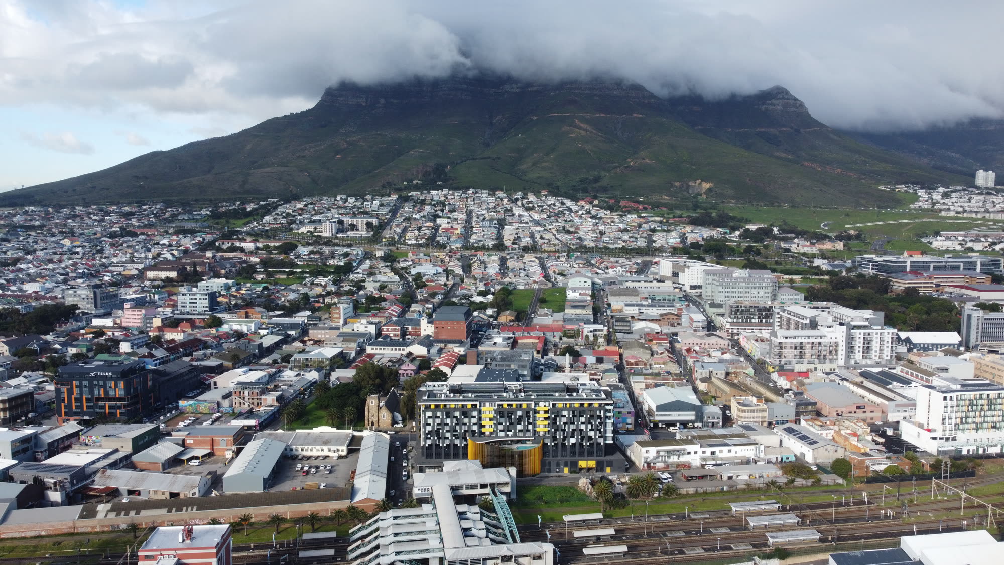
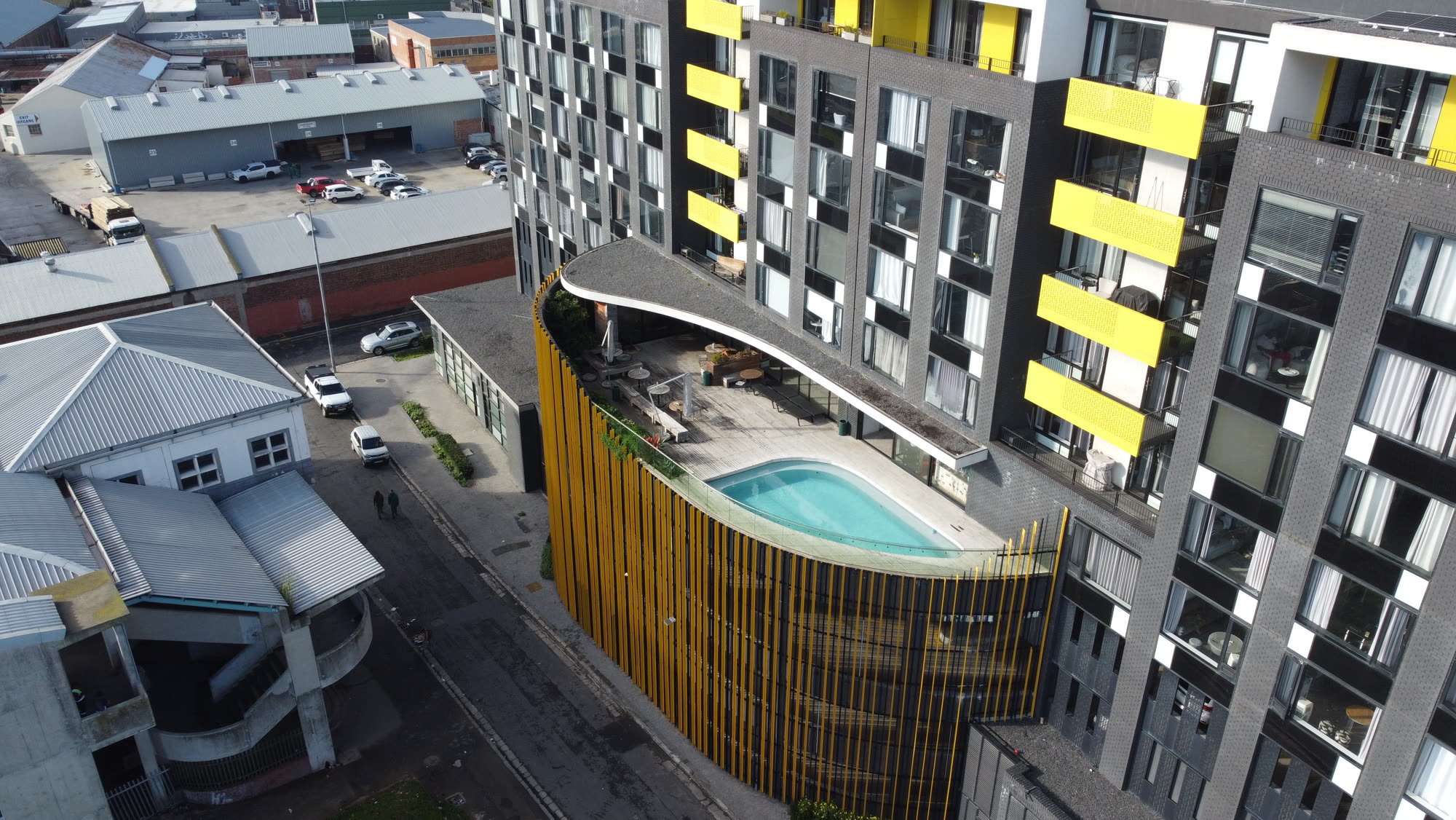
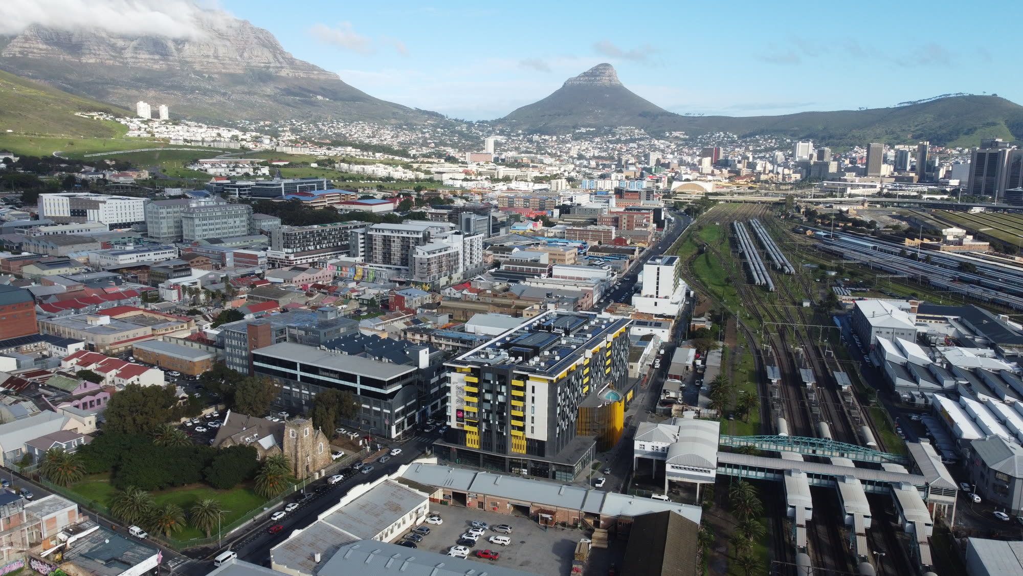
Drone photography for a two-bedroom apartment in Woodstock
BriefA two-bedroom apartment in Woodstock, where the value of an aerial plate is not the building — it is the position. Woodstock buyers are buying the walk to the city, the Table Mountain aspect and the harbour edge, and none of that reads from inside a flat.
ApproachA short, tightly planned flight in city airspace: launch point agreed with the building manager, daylight only, within line of sight, and framed to keep neighbouring units out of the plates. Three frames carried the set — a mid-height frame that places the block against the mountain, a harbour-side aspect that shows the city proximity, and a top-down that reads the street grid and the amenity within walking distance.
OutcomeA compact aerial set that gave a modestly priced listing the same locational storytelling usually reserved for high-value stock.
Frames from this shoot are being cleared with the client before publication.
Drone Photography & Video — questions clients ask first
Property and brand aerials are flown in daylight, within visual line of sight, below 400 feet, with written owner consent and a logged flight record. Where a brief needs controlled-airspace clearance or a certified commercial operator, we book it through a partner who holds the relevant SACAA approvals and quote it openly.